Review: Placing History (III)
(This is the third installment of my review of Placing History. See the first and the second parts.)
I’ve finally finished Placing History: How Maps, Spatial Data, and GIS are Changing Historical Scholarship. As my previous posts have made clear, I’m quite impressed with the breadth and depth of the compilation. As before, I’ll briefly recount the remaining chapters, and wrap up my thoughts at the end.
“Mapping Husbandry in Concord: GIS as a Tool for Environmental History,” by Brian Donahue. I liked this chapters for a multitude of reasons. On a personal note, his research is quite similar (though wider in scale) to the work I did in mapping property holdings and transactions of Venture Smith. So in a self-congratulatory mood, I found myself nodding with satisfied agreement at his various points about the benefits and drawbacks to mapping land deeds and parcels. On a less personal level, I liked the various angles he took in pursuing his study of Concord - especially examining seemingly disparate holdings of a variety of original families and noting patterns of land use.
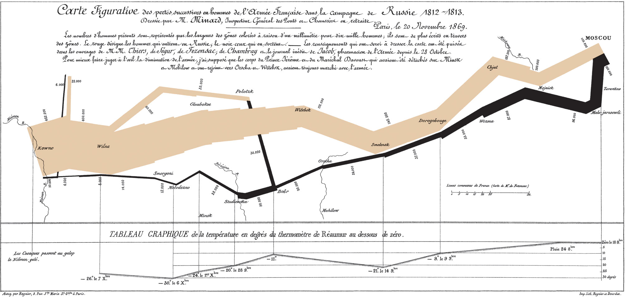
“Combining Space and Time: New Potential for Temporal GIS,” by Michael Goodchild. For starters, the cover illustration for this chapter was a piece of Charles Minard’s famous “Carte Figurative,” which depicts a staggering array of geographic, temporal, and statistical information regarding Napoleon’s ill-fated Russian campaign:
[caption id=”attachment_82” align=”aligncenter” width=”450”] [/caption]
Information graphic guru Edward Tufte described it as “the best statistical graphic ever drawn,” which effectively canonized it for any map and information graphic nerd such as myself. This is a roundabout way of saying I was excited to start reading Goodchild’s chapter. Goodchild doesn’t dissapoint, as he uses decades of geography experience to explore ways in which the field is gradually shifting to incorporate temporal data. Although its heavy on technical geography, it’s a rewarding chapter that covers one of the fundamental challenges of historical GIS: how do you visually display the relationship between space and time? Goodchild predicts that this challenge will rapidly diminish, as tools and systems to display things such as dynamic data, or even a history-specific model, will become more and more accessible and widespread.
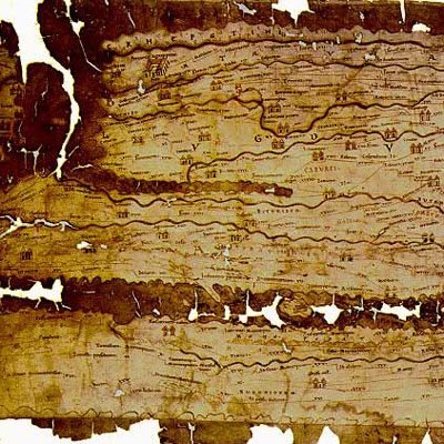
“New Windows on the Peutinger Map of the Roman World,” by Richard J.A. Talbert and Tom Elliot. Talbert and Elliott present an analysis of the Peutinger Map, a nearly 7 meter long Roman map depicting the Mediterranean world and beyond, constructed around 300 CE:
I liked this chapter a lot, despite my complete unfamiliarity with the subject matter. The authors make compelling arguments backed by GIS analysis, such as: “the basis of the map’s design was not its network of land routes (as has always been assumed) but rather the shorelines and principal rivers and mountain ranges, together with the major settlements marked by pictorial symbols.” They present a quantitative analysis of routes, and utilize a histogram to further examine the segments and their distances.
“History and GIS: Implications for the Discipline,” by David J. Bodenhamer. This chapter, along with the first chapter and conclusion, gives the best “big-picture” perspective on historical GIS. Bodenhamer describes the field of history as a whole, in particular elements of it that relate to spatial analysis. He believes that in order for GIS to become a valuable historical tool, “it must do so within the norms embraced by historians…” GIS is well-situated to do so, because it uses a format of presenting information (the map) that historians are already familiar with, and its visualization and integration of information makes it easier to display the complexity of historical interpretation. He also discusses the challenges to historical GIS. One point I really liked was that technology as a whole, and GIS in particular, often requires a level of precision that historical documents cannot display within “a technology that requires polygons to be closed and points to be fixed by geographical coordinates.” Other challenges range from the theoretical (ex. temporal analysis) to the practical (ex. learning a completely new discipline). Finally, he succinctly sums up one of the greatest challenges: “GIS does not strike many historians as a useful technology because we are not asking questions that allow us to use it profitably.” I could not have said it better myself - until historians begin to ask the type of questions that can be addressed through spatial analysis, GIS will likely remain a technological oddity within the discipline.
“What Could Lee See At Gettysburg?” Anne Kelly Knowles. This is probably one of the most accessible chapters in the book for a layperson. It combines an engaging narrative prose with rich, stylistic maps, and a “popular” subject matter (the Battle of Gettysburg). But more importantly, it clearly presents an answer to a historical question, while contextualizing the issue and presenting possible ideas for future studies. Viewshed (line-of-sight) analysis is of obvious and particular interest to military historians, but it has other implications as well. In particular, this chapter illustrates the phenomenal power of GIS to transport the reader to the past, and get a micro sense of “being” there.
Beyond thoroughly enjoying Placing History, I believe it’s an important contribution to the field of historical methodology in general, and (of course) historical GIS in particular. The compilation gives a wonderful balance while thoroughly exploring the topic: its current state and background, case studies ranging from micro to macro and “hard” to “soft”, discussions on theory and approach, and an outline for the future. I recommend the book to educators, historians, digital humanists, or anyone with even a passing interest in a growing and valuable area of scholarship.
